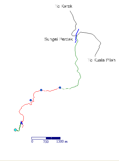
Powerful Seminyang A GPS map of the region. The black line is the road from Karak to Telemong.The red line indicates the part of the track where a 4WD is advisable.The green line is the trail to the waterfall. BACK
A GPS map of the region. The black line is the road from Karak to Telemong.The red line indicates the part of the track where a 4WD is advisable.The green line is the trail to the waterfall.
BACK